
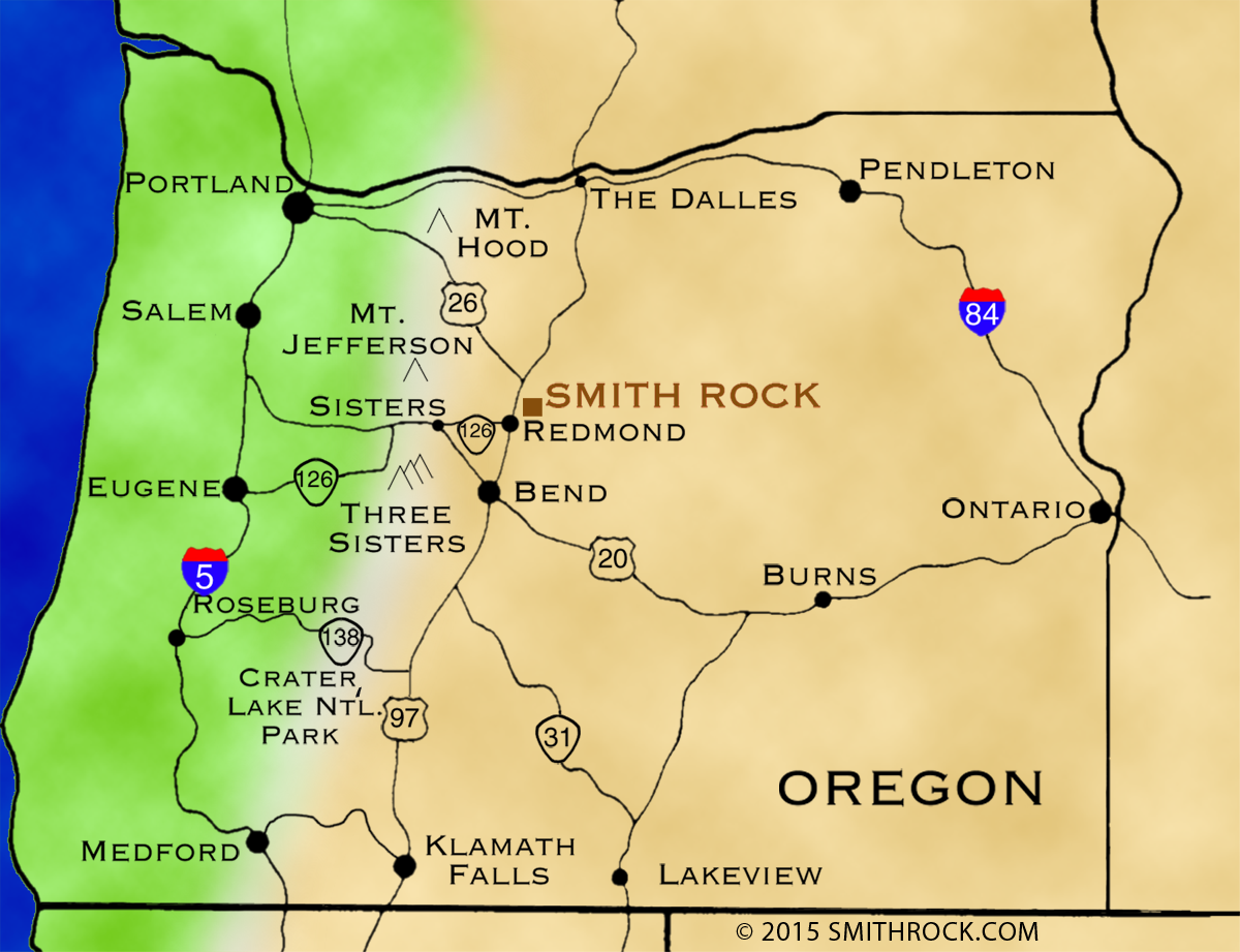
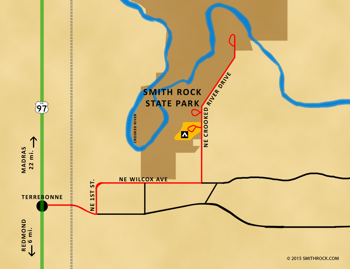
Smith Rock State Park can be tricky to find by just the signs.
Located just 3 miles east of highway 97 from the tiny town of Terrebonne, there's a big brown state directional sign on the east side of the highway by the yellow highway light. If you drive completely by a cluster of a few restaurants and a gas station you've gone too far.
Check out the maps below for directions on how to get here. Click to enlarge.

Got GPS?
Smith Rock State Park latitude & longitude: 44°21'58.01"N, 121° 8'13.32"W or 44.367612, -121.138988
In the Northwest or Oregon already?
Here are some typical driving times to the park for you to plan your trip:
Seattle - 6 hours
Portland - 3 hours
Eugene - 2 3/4 hours
Bend - 30 to 45 minutes
Redmond - 15 to 20 minutes
Terrebonne - 5 minutes
Conditions and travel information: